DISTRIBUTORS
About

MOBILE MAPPING


Mobile mapping is a method used to collect and geo reference data.

The term is very common amongst cartographers and topographers but those who are new to it may ask what it means.

WHAT IS MOBILE MAPPING?


Mobile Mapping Systems are the combination of various navigation and remote sensing technologies on a common moving platform.
They are capable of providing fast, efficient and complete data collection. There are often three main components in MMS: positioning system, camera(s) and lidar.

The positioning is done through GPS/GNSS and inertial measurement units. By using these systems, the data can be recorded continuously and accurately.

The images recorded are taken through the use of RGB cameras that are equipped with a CMOS global shutter or CCD sensor through which the colored images of persons and objects are acquired.

Lidar, Light Detection and Ranging, is a remote sensing method that uses light in the form of pulsed laser to measure ranges to the Earth.

In recent years, it has become one of, if not the, most important geospatial technologies available. Areas that are inaccessible can be mapped effectively thanks to the mobility of the platforms and areas that would have taken weeks to survey can now be done in only a few days. This technology is already used in road and rail maintenance, mapping projects and to improve the safety of infrastructures.

Surveying road and rail networks with Imajbox® 3TX+ and Imajbox® 360HD.

One geo-referenced image after another — Imajbox surveying linear networks.

Road
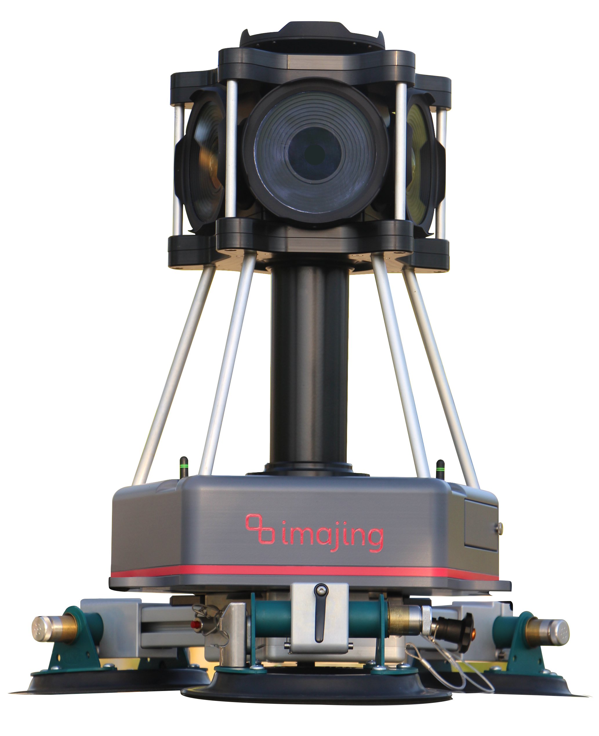
360HDimajbox® 360HD mobile mapping sensor
3TX+imajbox® 3TX+ mobile mapping sensor
Railway
3TX+imajbox® 3TX+ mobile mapping sensor
360HDimajbox® 360HD mobile mapping sensor

Each dot is a geo-referenced image captured along the network.

At imajing, the problem was handled differently. Instead of accumulating various separate data sources to have each one serving a single need, we have tried to minimize the data volume and optimize the use of each element in order to leverage them with the other parts. We believe it is more efficient and practical. For example, on the imajbox® mobile mapping system, we use the camera sensor to generate a new source of relative orientation that is integrated in the navigation kalman filtering to improve GNSS/IMU solutions.

From our RGB sensor, we not only provide fancy images, but we also calculate the depth with different techniques (feature tracking, correlation, AI) to deliver information at the smallest computing cost according to the needs, while minimizing data storage.

From a practical standpoint, being able to easily handle the system and move it onto any car, truck or train rapidly is the key to reactivity. It also helps to reduce overhead and logistics costs and allows anyone to run a survey by themselves. This is made possible by the size and weight of imajing’s mobile mapping technology. Doing measurements from images is also a benefit because it allows us to work from behind a windshield, which can’t be done with lidar.

The imajbox® mobile mapping technology integrates all of these concepts and delivers the information needed on a very large scale, at a minimized operational, computing and storage cost. As a consequence, running regular surveys becomes affordable when using imajing mobile mapping technologies, enabling new approaches in network monitoring and change detection.

Imajing’s solutions

Mobile mappers

Capture global-shutter planar or panoramic imagery with centimeter-level accuracy.

Mobile mapping to GIS desktop production software

Import point clouds or imagery from any sensor, whether from Imajing or third-party systems.

Work on multiple datasets in parallel within the same environment to digitize information, create databases, build linear referencing systems, apply GIS symbology, and much more.

Imajview

Web geoservice with integrated AI GIS production

Manage your networks online, collaborate on the same up-to-date data, and automatically produce large volumes of GIS information with AI models integrated directly into the platform for road and rail applications. Work with the full Imajnet® experience on PC, and stay connected in the field with the smartphone version, designed for fast and convenient data consultation on the go.

Imajnet AI

imajbox® mobile mapping systems


  • imajbox® 3TX+ compact mobile mapping sensor for road and rail surveying

    3TX+

    What for?

    • For cars, trains, bikes, trucks, boats, helicopters...
    • Survey roads, railways, bike paths, waterways, electrical lines…
    • For mapping, asset inventory and assessment, project preparation and follow up…
  • imajbox® 360HD mobile mapping camera capturing 360° geospatial data from a vehicle

    360HD

    What for?

    • For cars or vans.
    • Survey cities, roads, electrical lines...
    • For smart cities, 360 images, mapping, asset inventory and assessment, project preparation and follow up...