
Locate yourself in the field

Get your position in linear coordinates directly from your smartphone.
Imajing LRS App enables field teams to know their real-time position along a linear infrastructure.
It converts the smartphone’s geographic position into linear coordinates, helping users locate themselves quickly along a road, railway line or any other network equipped with a Linear Referencing System.
When the user is not directly located on the route, the application displays the linear reference of the nearest point, together with the distance and direction required to reach the network.


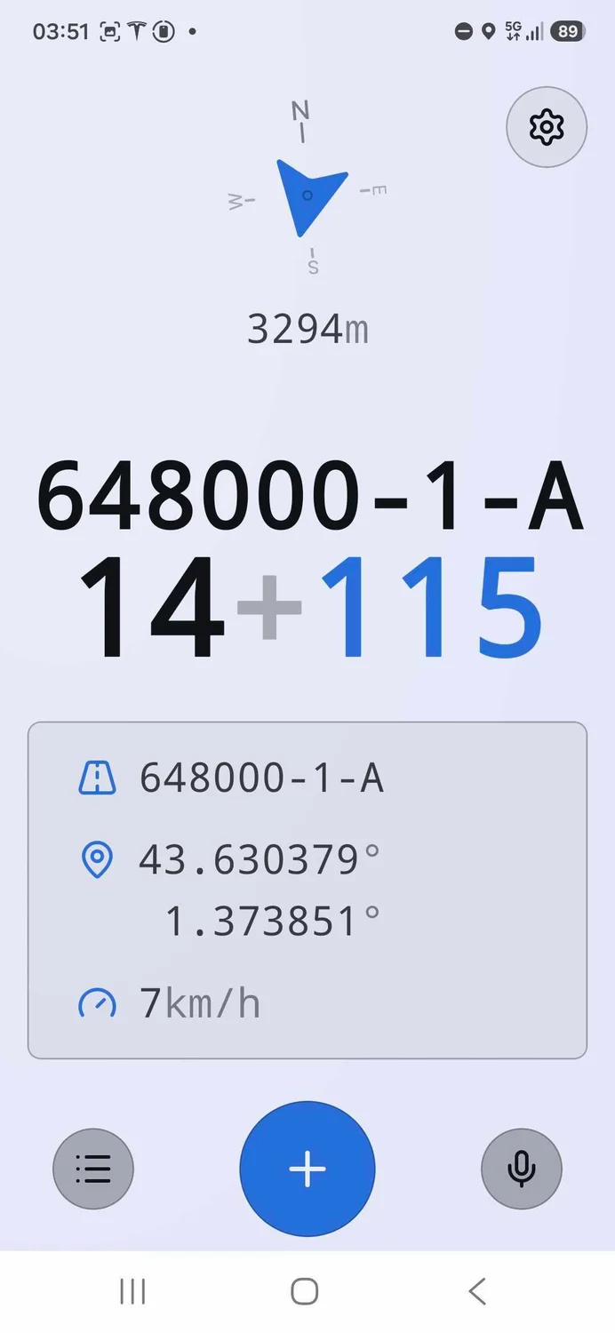
See your position on the network immediately, straight from your smartphone.
Get your position as linear coordinates matching the referencing system of the infrastructure.
When you are away from the route, the application automatically identifies the closest part of the network.
Check the distance between you and the infrastructure, and the direction to follow to reach it.
Imajing LRS App makes it easier to locate teams, operations and equipment on linear infrastructure networks.
It can be used for inspections, maintenance operations, incident reporting, asset location or the coordination of interventions on road and railway networks.
With Imajing Capture and Imajing LRS App, field teams can produce new data, enrich existing information and locate themselves accurately on their infrastructure.
All the useful information is integrated into Imajnet®, where it can be consulted, analysed and shared within a single collaborative environment.